Expression of Interest Received
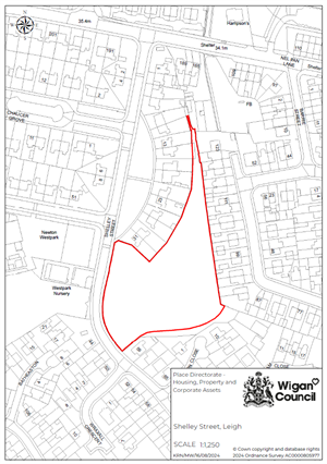 Site: Shelley Street, Leigh- Wigan Council
Site Size: 0.67 hectares / 1.7 acres
Development Opportunity
Wigan Council is seeking interest from developers for a residential led scheme.
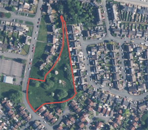
Site Overview and Potential
The site forms a large, open grassy site in an established residential location, with Newton Westpark Primary School to the west of the site.
The site is mostly square, although there is a narrow area on the northern end of the site which is likely to be too narrow to develop.
Location / Connectivity
 1km from A579, Atherleigh Way, which links to both the A6 and M61.400m of a bus stop
- 800m from Hag Fold Train Station
- Within 1 mile of Leigh Town Centre, which is currently subject to major regeneration activities.
View red edge map of Shelley Street development opportunity.
Land ownership: Wigan Council